
GPS / GNSS Survey Dubai & UAE
RTK and static GNSS for control networks, large-area mapping, and project verification.
What Is GPS / GNSS Survey?
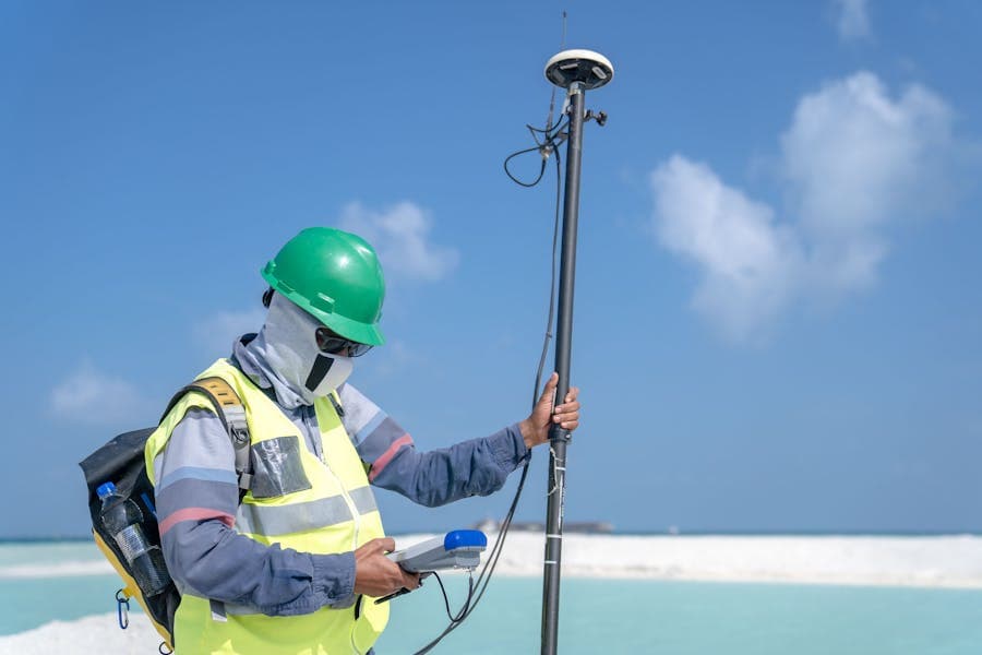
GPS and GNSS (Global Navigation Satellite System) survey uses satellite positioning technology to determine precise three-dimensional coordinates across large areas and open sites where conventional total station methods are impractical. Modern multi-constellation GNSS receivers — tracking GPS, GLONASS, Galileo, and BeiDou simultaneously — achieve centimetre-level accuracy in RTK (Real-Time Kinematic) mode and sub-centimetre accuracy in post-processed static mode. In the UAE, Vigo Burj connects to the UAE National RTN (Real-Time Network) for RTK correction, ensuring all GNSS survey work is tied to the UAE national coordinate reference framework and accepted by Dubai Municipality, Abu Dhabi DMT, and other authorities.
- Discipline
- Land Surveying
- Coverage
- UAE-wide
- Standards
- FIG · ISO 19650
- Leica
- Trimble
- Topcon
- Faro
- FIG
- RICS
- ISO 17123
- ISO 19650
- BIM Level 2
- UAE National BIM Programme (NBP)
- DEWA Regulations
- Dubai Municipality Standards
- UAE Civil Defence Code
How we deliver gps / gnss survey
A disciplined four-stage process applied to every land surveying engagement — residential to industrial.
- 01
Brief & site recon
Scope, accuracy, deliverables, and access agreed in writing before mobilisation.
- 02
Field work
Calibrated equipment, documented method, named lead surveyor on every site.
- 03
Processing & QA
Office processing with a second-engineer review before any deliverable leaves.
- 04
Handover
Drawings, raw data, and a written report — formatted for your team or the authority.
You may also need
Pair this service with closely related work for a single coordinated handover.

Control Points Establishment
Primary and secondary survey control networks tied to UAE National Grid and UAE-RTN.
Learn more
Topographic Survey
Precise mapping of ground elevations and site features for design and construction across the UAE.
Learn more
Demarcation Survey
Plot boundary marking and verification for DLD submissions, leasehold, and dispute resolution.
Learn more
Ready to start your next project?
Tell us about your site or programme. We will respond within one business day with a clear scope, schedule, and fixed-fee quote — no obligation. UAE-wide availability. International projects welcome.